An Introduction to Understanding Stream Recover From Flood Events

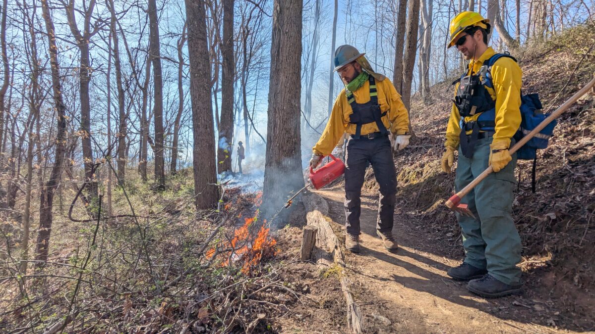
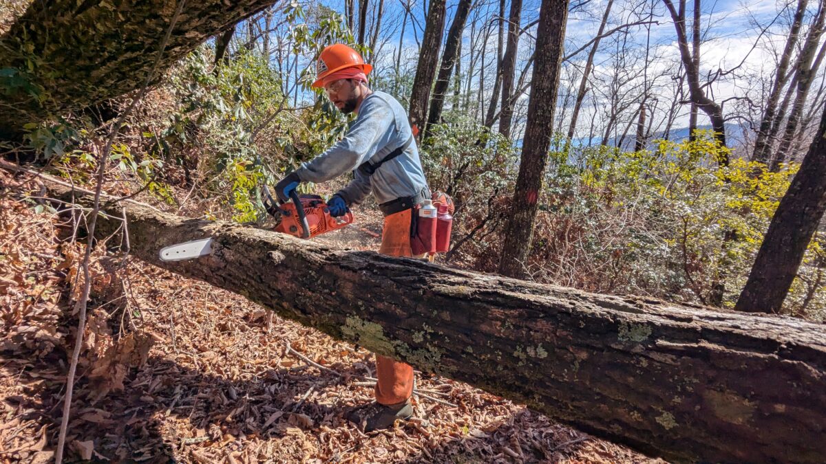
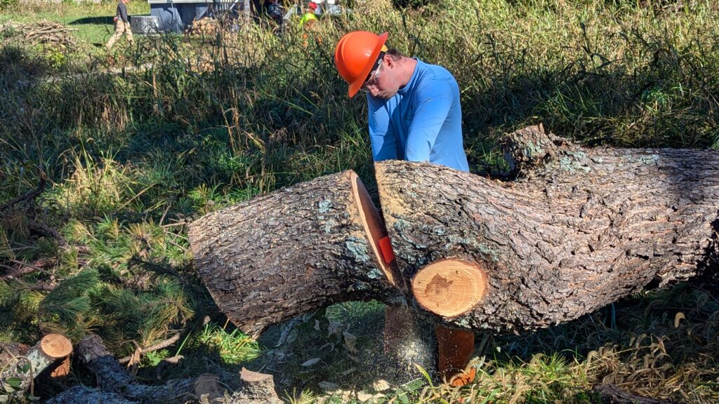
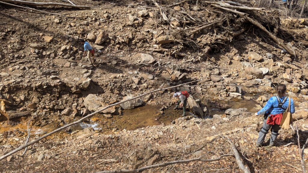
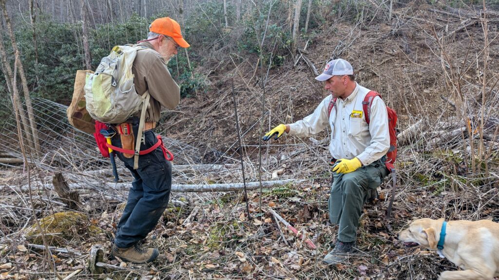
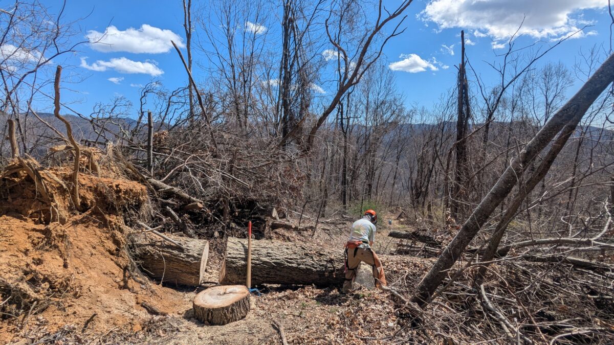
Ecoforesters has done amazing things to help streams recover on my projects at Wildlands Engineering. They have helped reduce invasive species pressure on riparian reforestation, an important step in stream and wetland mitigation projects. Reforestation supports the goal of maintaining shaded streams and stable banks. Our projects enjoy reasonable funding and benefit from the input of a diverse group of professionals through the phases of planning, design, implementation, and maintenance. For landowners of working lands in agriculture or forestry, resources for stream management can be more constrained and streams can present significant management challenges, especially in the aftermath of Hurricane Helene. Streams are resilient, but recovery takes time. 

Rather than try to address frequently asked questions on stream recovery the goal of this article is to establish a stronger base of understanding in dealing with streams and to offer guiding principles that can help landowners to evaluate and plan future projects, along with providing some resources to further your understanding and learn more.

Understanding Your Stream:

The first guiding principle is to spend time understanding and assessing your stream’s characteristics. Streamstats (https://streamstats.usgs.gov/ss/) will delineate your watershed and provide a report on the land area and land uses that drain to your stream. Using regionally collected “bankfull” geometry data, it will also predict the typical width, depth, area, and range of flows you may anticipate on your stream. (A .kmz file can be downloaded and opened in Google Earth as one option for visualizing the watershed draining to your stream). Other websites, such as NC OneMap, provide aerial photography (https://www.nconemap.gov/pages/imagery) and topographic information from high-quality Light Detection and Ranging (LiDAR) (https://www.nconemap.gov/pages/elevation). NCDOT has historic aerial photography of high quality that can be used to understand historical conditions (https://www.arcgis.com/apps/mapviewer/index.html?webmap=91e02b76dce4470ebd7ec240ad202a04). Streams also behave and function differently based on their landscape position and the shape of their valley. Understanding your watershed, natural stream geometry estimates, and the land use history provides a basis for evaluating existing conditions and management actions.

Learn Your Steams History:

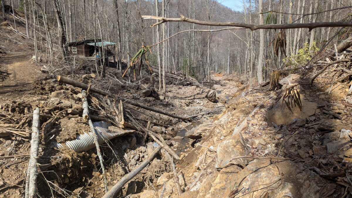
Historically, streams and watersheds have been highly manipulated. Watersheds were clearcut in the late 1800s and early 1900s in Appalachia. Many streams were either relocated to the side wall of the valley or straightened into ditches to improve drainage and expand agricultural production. These legacy activities set the stage for how channels respond to flooding today.

For example, streams confined by berms or deepened through ditching or erosion will accelerate their downcutting. This reduction in floodplain access means ever-increasing stress on the channel, causing larger and more material to mobilize during high flows and accelerating the erosion cycle. Eventually, the channel banks collapse, and the channel widens, working towards forming a new floodplain at a lower base stream level.

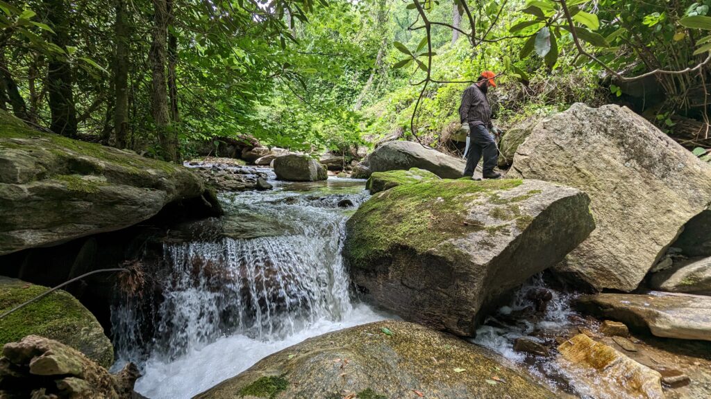
Stream downcutting propagates through a process called head cutting. This form of erosion occurs from downstream to upstream, lowering the channel, which can increase streambank heights and threaten crossings. Advancing headcuts pose a risk to the upstream channel and understanding when these exist is an important part of evaluating future risk. Observing streams in less disturbed settings can help you understand current conditions and evaluate potential uplift or management strategies.

Define Your Role:

Finally, when considering your role in stream recovery, it’s important to align your actions with your goals. Stream restoration professionals often employ a pyramid framework for improving parts of the stream system that they can more readily influence – often the physical, hydraulic, geomorphic or physicochemical conditions. The pyramid is influenced by geological factors and climate which drive the hydrology of streams, along with land use. (https://stream-mechanics.com/stream-functions-pyramid-framework/)

The resources presented here can help you make sense of your role and improve the basis for your decision making. The problems themselves will be much more complicated and will require tough decisions and likely a prioritization of efforts based on available resources and viable options. I encourage you to talk to people in the community that work in stream and watershed management professionally who may help educate and guide you with how to approach problems and what options you may wish to consider. Try to be open to the possibility that the long game may be the most effective. Remember, streams are a common resource and by positively influencing your stream, you are helping your neighbors to reduce flooding or sedimentation or enhance fisheries and aquatic life on their land. Also, it is understandable that at times expediency and cost will drive your decisions. Try to consider what you can do today, this year, this decade and in your lifetime. Additionally, sometimes engineered solutions can only go so far and management solutions that require sacrifice are the only thing that can further influence outcomes. 

Actions that consider increasing flood frequency due to climate change, the nature of streams and their need to access floodplains to function properly, and the influence of land use on hydrology as well as the influence of prior manipulation on current stream behavior will have greater long-term success.

The Science of Fuel Loads

If you were around WNC in the fall of 2016, you remember what a significant fire season that was. In the spring of 2025, we are having another significant fire season. This is largely because of the prime weather conditions for fire behavior such as high winds, low relative humidity, air temperature, and low fine fuel moisture. In some part, the amount of woody debris from Hurricane Helene has increased fuel loads across the area. Downed trees and landslides have added to the complexity of wildfire response. In the midst of spring fire season, and without significant research, it’s too early to tell exactly how much the actual ignition of downed trees have played into increased wildfire risk.

For a fire to occur we need 3 things; fuel, heat, and oxygen. Of those 3, landowners and natural resource managers can impact fuels the most. The larger the size of the fuel, the more energy is needed; not only to ignite it, but to cause complete combustion. Sometimes large fuels (such as logs) will ignite and smolder from the outside, but never fully burn all the way down to ash. 

The finest fuels are the principal ones to ignite, such as leaves, needles, grass, and even moss are called 1 Hour fuels. They comprise initial fire spread and the heating and combustion of larger fuels. Under dry conditions, these fuels are often flashy and cause surface flames to spread quickly. Small branches and leaves from ¼ to 1 inch in diameter are called 10 Hour fuels. Sizing up to 1-3 inch branches and limbs are 100 Hour fuels. Limbs and trunks 3-8 inches are called 1,000 Hour Fuels, and anything greater than 8 inches is considered a 10,000 Hour fuel. These 10,000 hour fuels typically do not support fire spread but can increase fire duration and severity. If fuel loading is high and distributed across the site (such as from storm damage), high fire severity can be more widespread and can increase both resistance to control and the duration of burning.

The designation of the “hour” of fuels signifies how quickly these fuels react to changes in moisture, with larger fuels taking longer to adjust to changes in atmospheric moisture. Imagine some of the once impressive landscapes, now full of storm damaged and blown down trees. Amongst the pick-up-stick like pile are a jumbled culmination of fuels ranging from 1 to 10,000 hours. Six months after Helene, many downed trees are still losing lots of moisture, so their full fire risk potential may not even be fully met.

There are many ways to reduce potential fire risk: being FireWise, targeted thinnings and forestry mulching to reduce fuels, and using prescribed fire. We’ve all heard the expression, “fight fire with fire”. That’s exactly what our Wildland Firefighters do, when they go into direct suppression. But what if we could use prescribed fire to serve as a multifaceted tool? 

Prescribed fire can be a very cost-effective way to reduce forest fuels as well as to meet forest restoration goals and improve overall forest health. One thing to remember is that one burn will actually promote thick growth in the understory, but a series of prescribed burns can help to create ideal forest conditions for sustainable long-term ecosystem health (especially in mixed oak and oak-pine forests). 

Since the Fall 2016 wildfires, public interest has spiked regarding prescribed burning. Following this buildup, landowner demand for prescribed burning services has also  increased. Nearly all plans for any type of mixed oak or oak-pine forest will recommend the use of prescribed fire. We can only hope that post-Helene, not only the interest, but more importantly, the willingness and demand for landowners to use prescribed burning will increase.

Wreckage to Renewal

Overnight, the buds have started bursting. Spring has a special knack for enlivening the mood, regardless of the year and what it’s held. For the past six months we have been living amongst the wreckage of Helene, watching the constant stream of debris being pulled from our waterways while there is a steady hum from chainsaws clearing hazard trees. From bucking trees off of houses in October to helping folks understand the changes to their land this Spring, EcoForesters’ staff has been extremely busy. But there is a lurking problem about to rear its head from the soils beneath. Populations of non-native invasive plants in our mountain region have been dormant in the topsoil, waiting for some sunshine and newly found real estate. Now that there is plenty of “free real estate” amongst the fallen trees, aggressive non-native invasive plants (NNIS) will be quick to set up shop and make themselves at home. 

Many folks have heard that NNIS are quicker to grow and quicker to spread vs. our native plant fellows. These misplaced plants inhibit native plant regeneration, provide minimal ecological value, and they often degrade our region’s biodiversity. One of the main ways they  spread is through disturbed bare soils, so if they were established prior to the hurricane, they will thrive after the hurricane. Now that it is early Spring, a lot of the non-native invasive plants have started to leaf out before plants native to southern Appalachia- making identification and treatment much easier.

EcoForesters has been moving quickly to help educate folks with post storm steps, such as how to identify and treat NNIS, where to find native plants, how to manage their bare soil, and disseminate information about funding to help in stewarding their land. Both of our forest restoration crews have been working tirelessly to accomplish the boots on the ground work within the community. This includes the important tasks of forest stand improvement and habitat restoration, in addition to clearing out access roads and trails.

The Southern Appalachians have been dealt a bad hand from this storm, but for the sake of optimism, let’s reframe it as a blank slate. There is now plenty of bare soil that has given folks a chance to steward the land with intention and mindfulness that can last generations. Thankfully, there are many organizations and community members that can lend a hand and share resources. It is disheartening to see the changes to our land from something that was beyond our control; thankfully, nature is resilient and can heal with a little help. With Spring comes a new opportunity to see what germinates – our natives will come back and we have to act as shepherds towards our natural ecosystems. In the scope of forestry, we’re playing the long game, so let’s plant natives, revive the soil and soul, and start the next chapter for our forests through diligent removal of NNIS. 

Hurricane Recovery

As I write this article, a little over 5000 acres are on fire in Polk County, about 37 miles away, and I can smell the smoke from my house. Jordan, an EcoForesters’ forestry associate, was scheduled to meet a landowner not far from the fire, but weather conditions and the remoteness of the area caused us to reconsider. In the world of forestry, safety and caution reign supreme.

I share this information  not to be alarmist, but to best share with our readers the challenges professional foresters and land managers are facing post Hurricane Helene. The unplanned disturbance that struck over 800,000 acres has left access to the areas that once acted as fire breaks impenetrable. A wildfire that once was put under control after burning only 1 acre is now a 15-20 acre fire. Drought-like conditions are creating headaches and dangerous situations for a lot of brave workers and communities alike.

Our staff has spent the last 6 months in the woods. Our field staff has stayed busy restoring access into the woods and planning for the future challenges that will come this spring. Our foresters have been assessing what it means to lose 50% of your trees over a 100 acre parcel. What is the cost and feasibility of removing tangled timber without further damaging property and streams? What is the right prescription for regenerating oaks where the movement of earth and trees has changed the environment? And most importantly, what will it cost?

The next 10 years of forest stewardship will be in reaction to Helene’s footprint and require an effort of similar magnitude. When disturbance happens in the absence of planning, regeneration and competing invasive plants are not considered. The planning decisions made today will help guide future wildlife populations, recreational opportunities, and future markets like biochar. This edition will share what we are seeing in the forest and how we are planning for the future. 

The greening of this spring will help all of our psyches. The response to new growing space will remind us that disturbance is an opportunity for natives and non-native species alike. While we are usually okay with letting nature duke it out, the winner getting the light and growing space, we know that past management has degraded species favorable to wildlife and given an unfair advantage to faster growing invasive plants. But with planning, education, training, and hard work, EcoForesters has begun the journey towards restoration. Thanks for coming along for the ride.

A Landowner’s Devotion

Sometimes, landowners are putting in the work before we even engage them. These “model” landowners know what they want to do and are actively making their forests healthier. This is sometimes as simple as developing a plan and putting it into action. However, Russ Oates will tell you that nothing in the mountains is simple.

Russ won our EcoForester of the Year Award in 2023 for many good reasons. He is one of the most devoted and directly involved forestland owners in stewarding and restoring his forest for biodiversity, forest health, and wildlife especially. After all, he is a retired wildlife biologist who worked for 28 years for the US Fish & Wildlife Service. He and his wife bought 192 mountainous acres in Yancey County in 1996 and “retired” to return to NC from Alaska in 2013. They bought an additional adjoining 22 acres in 2016. 

Over the past 28 years he has planted and tended over 1,200 trees that most benefit wildlife but need help getting established (oaks, hickories, chestnuts, cherries, spruce and fir) in small wildlife openings he created scattered across his property. The vast majority of these trees survived Helene and will be his legacy on the land. He visits every tree up to 3 times a year to control the more aggressive plants (with our crew’s help and some of our grant funding) that can outcompete the slower growing oaks to ensure there will be an even more diverse, resilient, and healthy future forest.

However, Helene took down roughly 15 acres of his mature forest: some with wind, but mostly by the large debris flows that tore through the 3 upper drainages on his property, which merged and continued down his formerly beautiful creek to create a bare ditch now up to 8 feet deeper and a devegetated area 30-160 feet wider than the creek was.

Fortunately, he had thoroughly controlled any non-native invasive plants on his original property long before Helene, so his forests will regrow well on their own with native plants, except maybe where it is now bare mineral (clay) soil – which is infertile, steep, and getting baked by the sun now that the trees are gone. However, despite this devastation, he has kept tending his planted trees – fixing up the damaged deer exclosures he built and installed on every planted seedling (once he realized he needed to do that about 5 years ago). He is also taking this as an opportunity to plant more in these newly disturbed areas.

His first priority is to get some vegetation established on these now bare, steep stream banks for immediate erosion control to stop more soil from washing into the creek and further impacting the previously very high-quality water. The simplest and quickest way to do this initially is to spread annual ryegrass (which is cheap, easily available and germinates in 3 days), some fertilizer, and straw mulch on these slopes: then, ideally on steep slopes, cover it with biodegradable coconut fiber matting to hold the seed in place. Once some vegetation is established, erosion will be greatly reduced. And then, he can overseed with more desirable and perennial native grasses and wildflowers. Next, as the annual ryegrass dies back over the summer, the naturally existing and additionally spread native seeds can grow and establish a nice native grass and wildflower stream bank this growing season. This work is still in the early stages, but will proceed further as more assistance is secured.

To truly stabilize these stream banks he is planning on getting perennial woody plants established with year round roots to really hold the soil in place. Fortunately, many floodplain species will grow roots by just putting a freshly cut branch at least half way (preferably 2/3rds) into the ground with at least 2 buds above the ground – called “livestaking”. Branches that are at least 1’ long and at least ½” in diameter work well for species such as willows (silky or black), dogwood (silky or red osier), elderberry, nine-bark, buttonbush, alder, spicebush, and even larger tree species such as sycamore, cottonwood, and river birch. (For more info see NCSU Extension Service’s publication: https://bae.ncsu.edu/wp-content/uploads/sites/3/2017/07/Small-scale-Solutions-to-Eroding-Streambanks.pdf).

Finally, he plans to plant a row of white oaks (the most desirable tree for wildlife), and possibly some shagbark hickories along the top of the stream bank. Russ has applied for Emergency Forest Restoration Program funding from the Farm Service Agency which will help offset the costs of his work. He is still waiting patiently to learn if he was accepted, but landowners that have a management plan and are mitigating wildfire risks should be well suited to be reimbursed for some of their expenses.

This is what one dedicated man (and a very understanding wife!) can do when he devotes his time and invests his money in improving his forest. It is likely that this forest will come back more diverse, resilient and healthy in the future – even after the destruction of Helene.

Helene Impacted Over 800,000 Acres of Forest

It’s safe to say that the damage from Hurricane Helene is unprecedented, creating challenges that will impact the landscape for generations to come. Our team has been using remote monitoring from satellites and drones to get a better understanding of the destruction, as well as the opportunities for restoration. Each forest stand will have its own unique challenges that EcoForesters and others will be addressing in the coming year, but here are insights into what we are seeing so far. 

In addition to the massive toll on people and development, many forests have been heavily damaged by Hurricane Helene. The main current concern to address quickly is the potential for ongoing erosion from badly damaged forest roads, landslides, or just ground disturbance.  Any disturbed soil should be stabilized and reseeded as soon as possible. 

Risk from more severe fires due to increased fuels is a concern too.  Clearing woody material at least 30’ away from structures is essential to reduce fire risk, possibly farther, then clear roads for access in case of fire with increased fuel loads. Firewise gives good directions for fire safety around homes. Community Resource and Conservation Districts may also have funding to help with Firewise practices. 

Water quality is of utmost concern and state regulations still apply in stream side areas. Even if trees are down in stream sides areas, ground disturbance still must be minimized in these areas to meet environmental regulations.

Damaged forests will re-grow. Virtually all of WNC was clearcut within the last 100-150 years. The forests we have (or had) were natural 2nd or even 3rd growth. It will take years and even decades, but hardwood tree stumps will resprout and ample native seeds have been left by the pre-existing forest. And we have a chance to shape the future forest to make it more diverse and of higher quality for wildlife and/or timber. As the forest regrows we can favor more desirable trees that need help (like oak) by releasing them from their more common competition or invasives. 

If invasives were or are present they will need to be carefully monitored and controlled, as they spread very rapidly and will take over the new growing space with more sunlight.  If not controlled they will outcompete and grow over native trees, stopping the natural forest from regenerating 

It’s important to document any damage done to your forest, infrastructure, or equipment before work is done for possible reimbursement by insurance or emergency relief funds.

Trees that came down or are badly damaged (>50% crown broken off) can be salvage logged, if still solid, but usually at no profit to the landowner. Finding loggers to work on salvage timber harvests could be the limiting factor.

Financial assistance is available for forestland owners impacted by Helene through the Emergency Forest Restoration Program. Your local county USDA office is likely to be your best first contact for that. Our work is just beginning. We will be surveying landowners soon to better understand needs, but please reach out to our staff if you have questions or need assistance.

Here are some key facts to determine feasibility for a salvage timber harvest:

1) Logs need to be at least 12” diameter at the small end and be solid for at least an 8′ length to have any value and only logs that are without any significant damage (e.g. no splitting) or major branches are merchantable.  

2) Downed timber is only merchantable for about up to a year before it starts to decay and loses all value.  Best to harvest high value timber as quickly as possible.

3) The primary merchantable, possibly, profitable species is oak (especially white oak); large yellow poplar and white pine are selling for close to the salvage logging cost (i.e. no profit for landowner).

4) Loggers usually want at least 10-acres of good timber, especially under these demanding circumstances.

5) Sites with good accessibility to, and around, them for large machinery are much more feasible.  Loggers and mills were already in short supply so only larger tracts with good access may be appealing.  

-If you are interested in finding a buyer here is a link to timber buyers searchable by county.

Here are some potential issues to consider:

A) Protecting water quality is the key first thing to do.  Stop any ongoing erosion from badly damaged roads, landslides, or any ground disturbance. 

B) Road building is the biggest impact of any woody material removal.  So logging/clearing still must be planned well especially with increased erosion risk.

C) Smaller (<12″ diameter at small end) or damaged timber and unmerchantable species will be left on site, so it won’t look good for a few years at least, until things regrow.  Though unsightly to humans often, the large amount of downed woody material is good mulch to prevent erosion and future fertilizer for the forest to regrow, as well as good habitat for small animals.  If you want your forest “cleaned up” that will be a significant cost to you.

D) The risk of a severe wildfire will increase with all this extra downed fuel, especially as it dries (starting in Fall of 2025).  So if there are large amounts of downed trees downhill from any structures or other areas you want to protect, then a cleared buffer area (30’ up to 100’ depending on many factors like the size of the material) should be established to reduce risk to areas you want protected.

E) But trees do regrow well naturally around here.  So planting should not be necessary, unless there is erosion and/or bare mineral soil. Hardwood (deciduous) tree stumps will resprout and grow quickly, and there are usually plentiful seeds. However, this also can be an opportunity to plant highly desired trees (like oaks) if you are willing to tend them every couple years for 5-10 years.  Similarly, with natural regeneration you could wait 5-10 years and then release the more desirable saplings.

F) After a major disturbance, it is important that many mostly intact trees (>50% live crown remaining), especially oaks and other trees that provide good food for wildlife, be left to provide some habitat structure and as future seed sources.

G) After disturbances, Non-native invasive plants can and will quickly infest more areas and/or become more severe.  They should be carefully monitored and controlled as needed, especially this coming spring before they get too bad.